Skip to content

Height from a single image.

DepthWizard turns one aerial or satellite image into a metric surface model, then lets you fly through it, validate it and export it. It works on a plain PNG, a JPG or a georeferenced GeoTIFF.
Cartosat-2S · 0.6 m/px · 1024 × 1024 · EPSG:32645

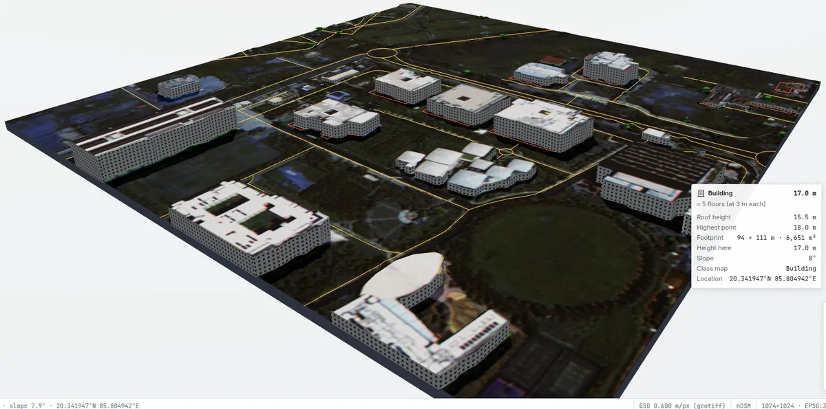
Try it: Infosys campus, Bhubaneswar. A single Cartosat-2S GeoTIFF (0.6 m, georeferenced) with DepthWizard’s predicted heights, the same sample that ships with the web app. Drag to orbit, right-drag to pan, scroll to zoom, and hover over a building to read its height and footprint. Switch layers to see the height map or the model’s land-cover classes. View on Google Maps · Source imagery: Bhoonidhi sample products
GAMUS test RMSE
3.32m
2,861 held-out tiles · TTA · r = 0.89
LiDAR · 30 m cells
1.35m
WorldView-3 vs airborne LiDAR, 8 sites
Cross-domain RMSE
4.97m
DFC23, a different sensor and continent
Encoder
303M
DINOv3 ViT-L/16 pretrained on 493 M satellite images
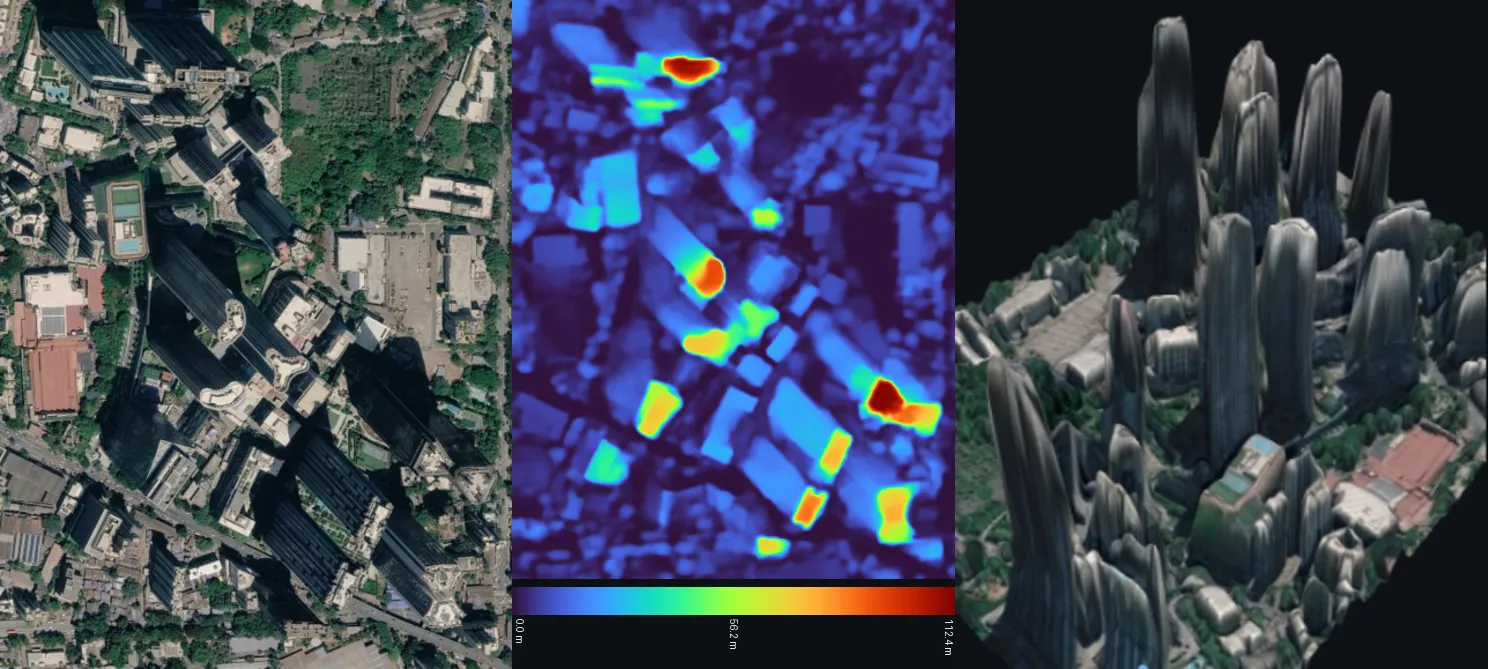
Input image, predicted height map and textured 3D render of a high-rise district
Without georeferencing, a screenshot is processed at an assumed 0.5 m GSD and gives a relative DSM. From left to right: the input image, the predicted height map (0 to 112.4 m) and the textured 3D render.Imagery © Google Earth.
Google Earth screenshot · 0.5 m/px (assumed) · 886 × 598 · relative DSM

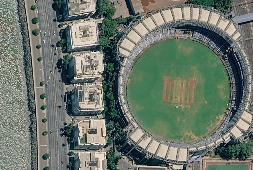
Wankhede Stadium, Mumbai. A screenshot from Google Earth of the Wankhede Stadium in Mumbai, with DepthWizard’s predicted heights. Source: Google Earth

Input imagePNG · JPG · GeoTIFFCartosat · WorldView · aerialPreprocessresolve GSD · 2–98 % stretchresample to 0.5 m · 512 px tilesHeight modelDINOv3 ViT-L/16 + DPTheight · classes · uncertaintyBlend & restore gridHann-weighted tile blend→ nDSM, metres above groundGeoreferenced?(GeoTIFF / DEM)yesnoAbsolute DSMDEM-anchored · metres (EGM2008)Relative DSM (rDSM)scale from assumed 0.5 m GSD3D viewer · validation · exportGLB · OBJ · PLY · STL · GeoTIFF · NPY
The pipeline end to end. Every input goes through the same height model. Georeferenced inputs are then anchored to a public DEM to produce an absolute surface model in metres. Plain images produce a relative model whose scale comes from an assumed 0.5 m ground sample distance.

Using the app

Go to the User guide. A first height estimate takes about a minute.