
LiDAR validation
The IARPA Multi-View Stereo 3D Mapping (MVS3DM) benchmark pairs WorldView-3 imagery of San Fernando, Argentina with airborne LiDAR. DepthWizard v5 was run on a pansharpened true-ortho of one scene (0.3 m, 5.4° off-nadir) and compared with a LiDAR nDSM at the 8 official benchmark sites. These sites form the test split in tools/pack_mvs3dm.py, and tiles within a buffer around them are dropped, so they were never trained on.
Per-pixel RMSE
3.38m
pooled over 13.1 M pixels · bias +0.35
30 m-cell RMSE
1.35m
1,488 cells · bias +0.36
Median ground error
≤ 0.11m
on LiDAR ground pixels, every site
Per site
Section titled “Per site”cartosat_2S_Sample/mvs3dm_results/summary.txt| Site | px RMSE | Bias | r | Conf. RMSE | 30 m RMSE | 30 m bias | Median gnd. err. |
|---|---|---|---|---|---|---|---|
| MasterSequestered1 | 2.59 | 1.17 | 0.65 | 1.71 | 1.32 | 1.17 | 0.11 |
| MasterSequestered2 | 2.45 | 0.64 | 0.68 | 1.62 | 0.93 | 0.66 | 0.09 |
| MasterSequestered3 | 4.83 | -0.06 | 0.84 | 2.10 | 1.93 | 0.11 | 0.04 |
| MasterSequesteredPark | 3.23 | 0.09 | 0.84 | 1.16 | 1.17 | 0.05 | 0.02 |
| Explorer | 2.55 | 0.16 | 0.76 | 0.90 | 0.89 | 0.14 | 0.00 |
| MasterProvisional1 | 2.54 | 1.02 | 0.68 | 1.51 | 1.26 | 1.02 | 0.04 |
| MasterProvisional2 | 3.31 | 0.80 | 0.85 | 1.29 | 1.41 | 0.81 | 0.01 |
| MasterProvisional3 | 6.67 | -0.37 | 0.82 | 1.60 | 2.60 | -0.23 | 0.00 |
Source: cartosat_2S_Sample/mvs3dm_results/summary.txt
Examples
Section titled “Examples”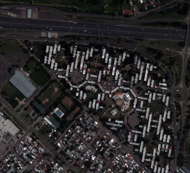 Explorer · RGB
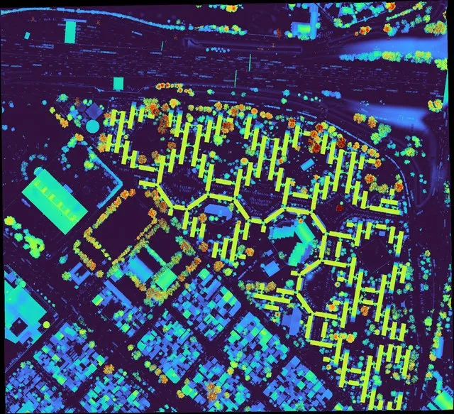 LiDAR nDSM
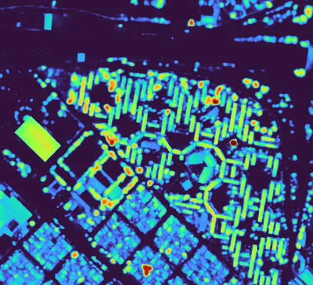 DepthWizard
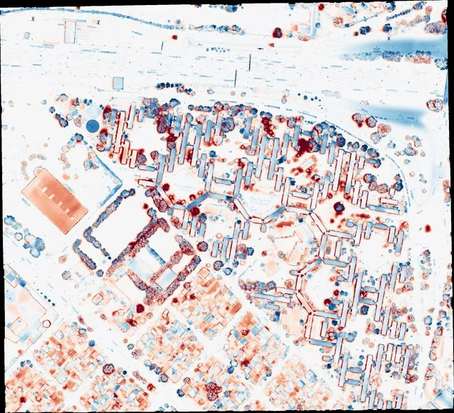 Error (−8…+8 m)
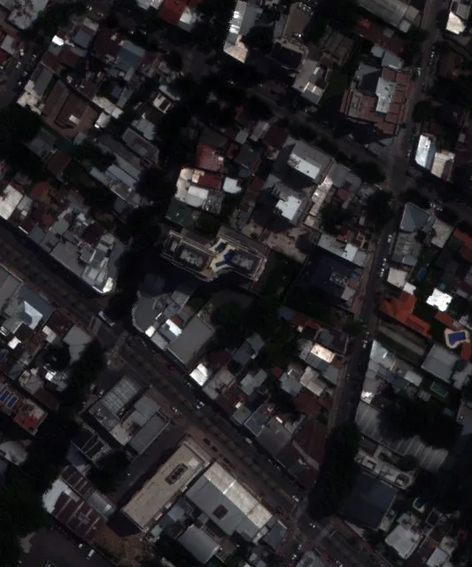 Sequestered3 · RGB
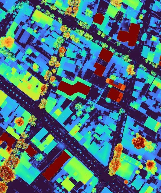 LiDAR nDSM
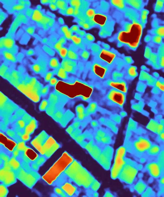 DepthWizard
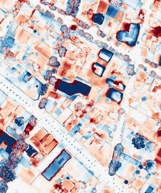 Error (−8…+8 m)